Hallstatt Boathouses: History on Lake Hallstatt
Architecture on Lakebed Stilts
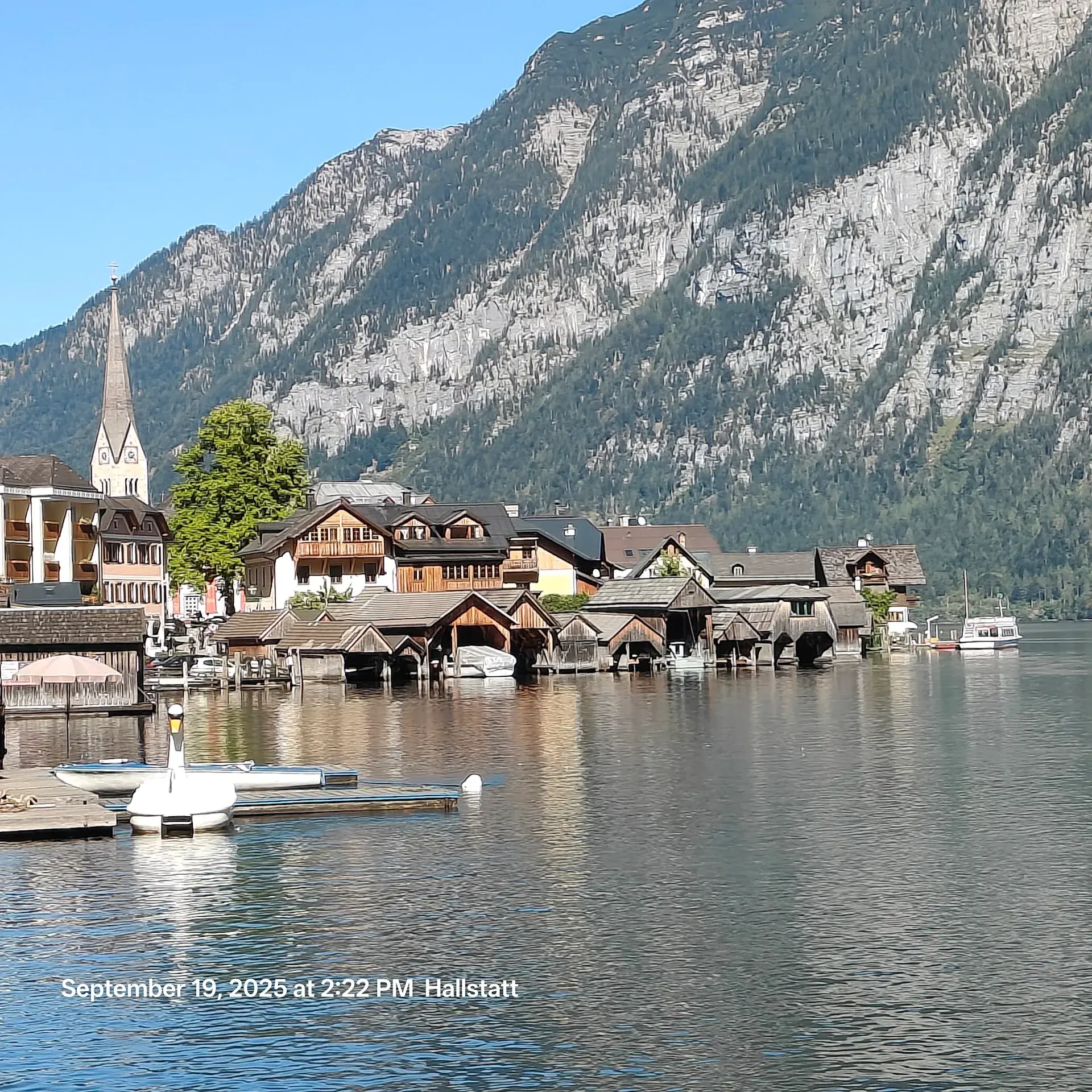
The traditional wooden boathouses (Bootshäuser) lining Lake Hallstatt (Hallstätter See) are a direct response to the region's dramatic topography. Wedged in a narrow corridor between steep mountain rock faces and the water, Hallstatt historically offered virtually no flat ground along the shoreline for building. To overcome this limitation, local builders drove wooden pylons and stilts directly into the lakebed, raising both boathouses and residential structures over the water.
Constructed primarily from weathered timber, these structures rest above the waterline, where the hollow sound of water lapping against the submerged support pilings is audible beneath the wooden floorboards. Built to shelter working watercraft, the boathouses effectively served as the community's primary access points during centuries of physical isolation.
The Historic Lifeline of an Isolated Town
Until the late 19th century, Hallstatt had no overland vehicle access. The town was accessible only by crossing the lake or by negotiating steep mountain bridle paths. Lake Hallstatt served as the main transport route, with watercraft providing the sole practical means to transport timber, provisions, livestock, people, and the town's lucrative salt reserves.
Space along the water was so constrained that traveling between neighboring houses along the shore on foot was often impossible without taking to the water. In 1794, travel writer Josef August Schultes documented that visitors had to navigate the settlement across rooftops and connecting attic bridges, as tightly clustered homes sat flush against the rock face.
The Traditional Fuhr Boat
The boathouses were originally engineered to shelter the Fuhr (also known locally as the Plätte), a flat-bottomed wooden vessel in use since at least the 13th century during the medieval revival of local salt mining. These boats were designed specifically for regional transport needs, featuring an asymmetrical, upturned bow called a Kranzling and a steering oar operated from a standing position. This specialized construction allowed the boats to navigate deep lake waters with heavy cargo while retaining the agility required for shallow riverbeds.
The craftsmanship and navigation techniques associated with the Fuhr am Hallstättersee remain active today. In recognition of this continuous maritime trade, the tradition was inscribed onto Austria's UNESCO National Inventory of Intangible Cultural Heritage in 2020.
The Seestraße and Modern Lakefront Use
Hallstatt's overland isolation ended in 1890 when the Seestraße cliff road was blasted into the mountainside along the western shore. Creating the road required significant structural changes to the shoreline, including the demolition of seven lakeside houses standing on pylons and the removal of a wooden walkway bridge known as the Panzelbrücke.
Today, the boathouses along the pedestrian route of the Seestraße continue to fulfill functional roles on the lake. While several annexes have been converted into waterfront holiday accommodations, many boathouses still shelter private vessels, support the upkeep of wooden boats, and house commercial rental operations offering electric, pedal, and rowing boats.
FAQ
Why were the Hallstatt boathouses built on stilts?
Because steep mountain cliffs left virtually no flat ground along the lake, builders drove wooden pylons into the lakebed to erect the boathouses directly over the water.
What is a Fuhr boat?
The Fuhr (or Plätte) is a traditional flat-bottomed wooden boat dating back to at least the 13th century. It features an upturned bow called a Kranzling and was engineered to transport heavy salt cargo across deep lake waters and shallow riverbeds.
When did Hallstatt gain overland road access?
Overland vehicle access arrived in 1890 with the completion of the Seestraße, a cliff road blasted into the rock face that required the removal of seven stilt houses and a wooden walkway bridge.
Discover Hallstatt like never before
Dive into Hallstatt hidden stories and secret spots with Ciceru interactive tours.
Explore tour
Audioguide
Quizzes
Maps
Solo
Couples
Groups & families

© Photo by Ai Fu CHIN via Google Maps · Google Places