Dreiflüsseeck: Passau's Three Rivers Corner
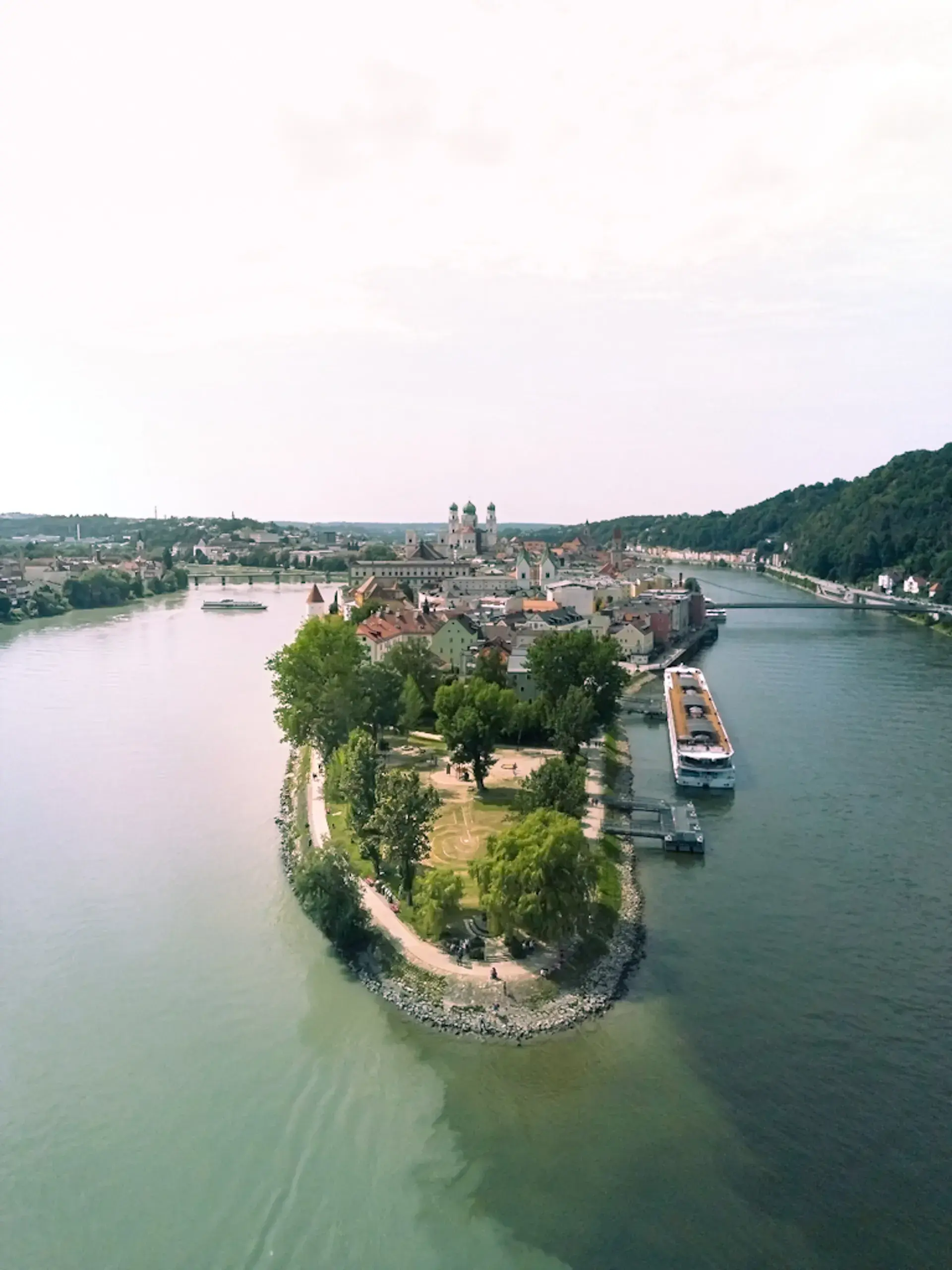
At the exact tip of Passau's old town peninsula, three rivers collide in a stark, lingering display of milky green, blue, and black water. The physical convergence of these waterways at the Dreiflüsseeck defines Passau's fundamental identity as the City of Three Rivers, having forced the historic old town to develop on the narrow walkable peninsula squeezed between them.\n\n## The Phenomenon of the Unmixed Rivers\n\nThe Dreiflüsseeck, located at the Ortsspitze park, offers a distinct visual contrast. Looking downstream, the Ilz flows into the Danube from the north, followed shortly by the Inn from the south. This creates a side-by-side striping of water colors: the milky green glacial sediment of the Inn, the blue or brown water of the central Danube, and the dark, inky water of the Ilz flowing from peat bogs and spruce forests.\n\nThis lingering separation is caused by a massive difference in river depth. The Inn is roughly 1.90 meters deep at the confluence and acts as an overcurrent, forcefully pushing its green water over the surface of the 6.80-meter-deep Danube rather than immediately mixing into it.\n\n## Why is the Combined River Called the Danube?\n\nDespite the Inn appearing stronger and carrying five percent more water annually due to Alpine thawing, the combined waterway continues eastward under the name Danube. This official designation is justified by length and consistency. The Danube travels 647 kilometers to reach Passau, compared to the Inn's 510 kilometers. Furthermore, the Danube maintains a steadier water level and carries a higher volume of water for seven months of the year.\n\n## History and Attractions at Ortsspitze Park\n\nThe tip of the peninsula was historically integrated into Passau's fortifications. Today, the freely accessible public park contains remnants of the medieval city wall, which originally began construction in 1250, with visible portions dating to the 16th century. At the very tip of the Ortsspitze, an anchor placed in 1971 stands as a monument dedicated to the victims of the Danube.\n\nThe area functions as a viewing promenade where visitors observe boat traffic and the river convergence. It also features a children's playground and serves as the official starting point for Passau's Planetenweg, a 4.8-kilometer scale model walking path of the solar system running along the Inn River.
FAQ
Why do the rivers at Dreiflüsseeck not mix immediately?
The side-by-side striping of the water colors is caused by a significant difference in river depth. The 1.90-meter-deep Inn acts as an overcurrent, pushing its milky green water over the surface of the 6.80-meter-deep Danube.
Which three rivers meet in Passau?
The Danube, the Inn, and the Ilz rivers converge at the Dreiflüsseeck. The Inn brings milky green glacial water, the Danube features blue or brown water, and the Ilz adds dark, inky water from peat bogs and spruce forests.
Why is the river still called the Danube after meeting the Inn?
Even though the Inn carries more water annually, the Danube is longer (traveling 647 kilometers to Passau versus the Inn's 510 kilometers), maintains a steadier water level, and carries a higher volume of water for seven months of the year.
Discover Passau like never before
Dive into Passau hidden stories and secret spots with Ciceru interactive tours.
Explore tour
Audioguide
Quizzes
Maps
Solo
Couples
Groups & families

© Photo by Sandy Birkner via Google Maps · Google Places