Rynek Wodny: Zamość’s Water Market History
The Vision of an Untraded Market Square
Rynek Wodny (Water Market) is the southernmost of three historic plazas laid out along the primary north-south axis of the Old Town in Zamość, positioned directly south of the Great Market Square (Rynek Wielki) along Morando Street. Conceived in the 1580s master plan designed by Venetian architect Bernardo Morando for Chancellor Jan Zamoyski, the square served as an urban counterbalance to the northern Salt Market (Rynek Solny). In Morando's humanist conception of an ideal city—where the urban fabric reflected human anatomy—these secondary squares functioned as vital organs balancing the civic heart of the town.
The square earned its name from its immediate proximity to the town’s southern fortifications and the Wielka Zalewa (Great Floodplain), an inundation basin fed by the Łabuńka River that reinforced the fortress walls. Despite the designation of rynek (market), the space was never used for commerce or trade stalls. Zamoyski and Morando strictly zoned the area for prestigious domestic quarters, accommodating high-ranking officials and the chancellor’s personal secretaries.
Evolution of the Urban Footprint
Morando originally plotted Rynek Wodny as a symmetrical square measuring 50 by 50 meters, organized with four residential plots along each frontage. However, none of the original Renaissance arcaded houses survived. Over centuries of military occupation and urban re-engineering during Austrian and Russian rule, the plaza’s boundaries shifted eastward, morphing into a rectangular layout measuring approximately 50 by 70 meters.
During the 19th century, imperial authorities adapted the plaza into a military riding school. Today, the northern and lateral frontages are lined with one- and two-story townhouses from the 19th and early 20th centuries. Notable among these structures are the former 19th-century public baths designed by architect Władysław Siennicki.
The Former Poor Clares Convent
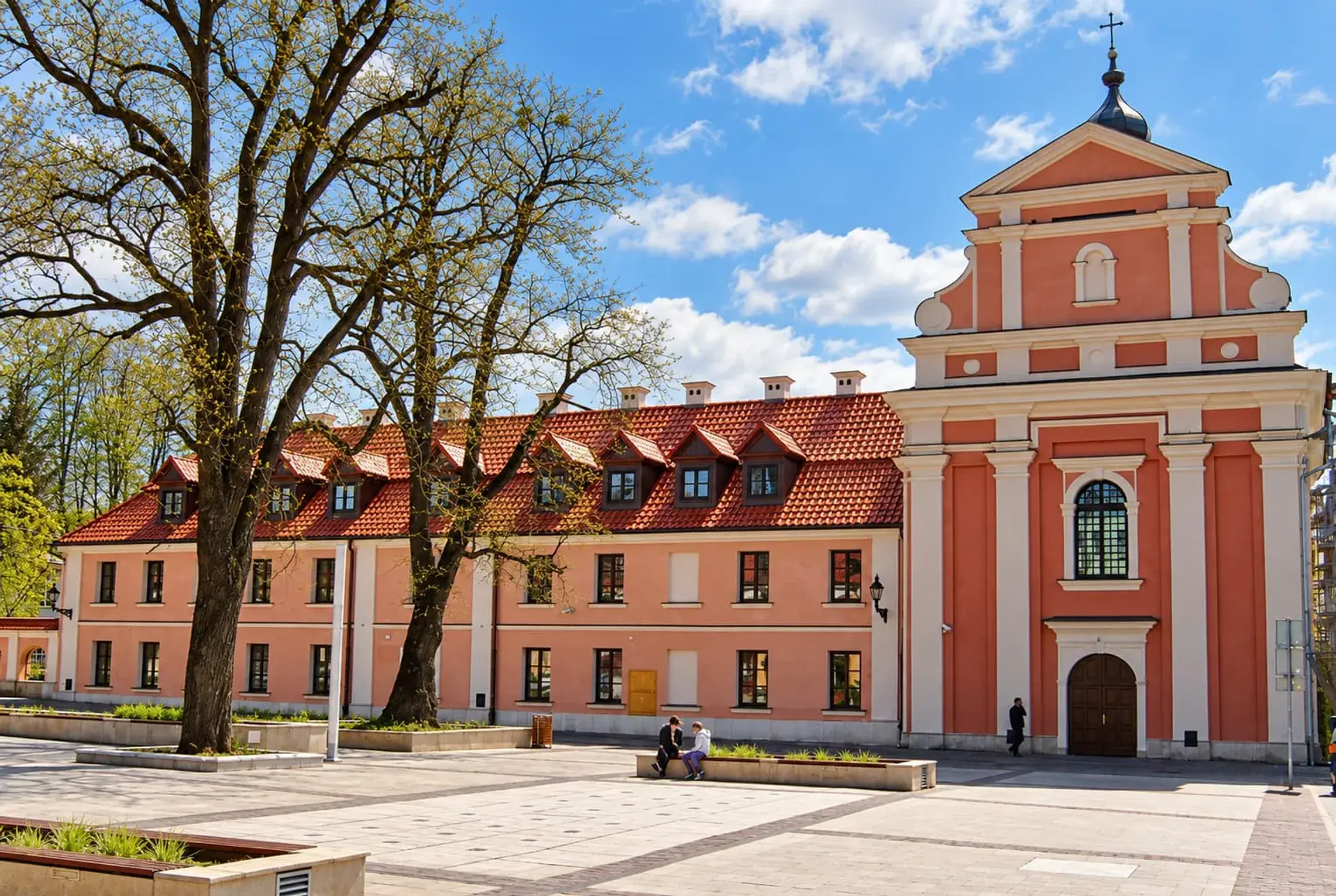
The architectural focal point of the southern frontage is the late 17th-century Baroque church and convent complex built for the Order of Poor Clares. Designed by military architect Jan Michał Link, the complex has undergone numerous operational transitions. Following the partitions of Poland, imperial authorities turned it into a military lazaret.
In the 20th century, the convent served as a state police headquarters before World War II and later operated as a state orphanage between 1949 and 1985. The historic complex now accommodates the Karol Namysłowski State Music School, frequently filling the surrounding open space with instrumental scales, piano rehearsals, and orchestral practices drifting through open windows.
The Air Reservoir and Modern Revival
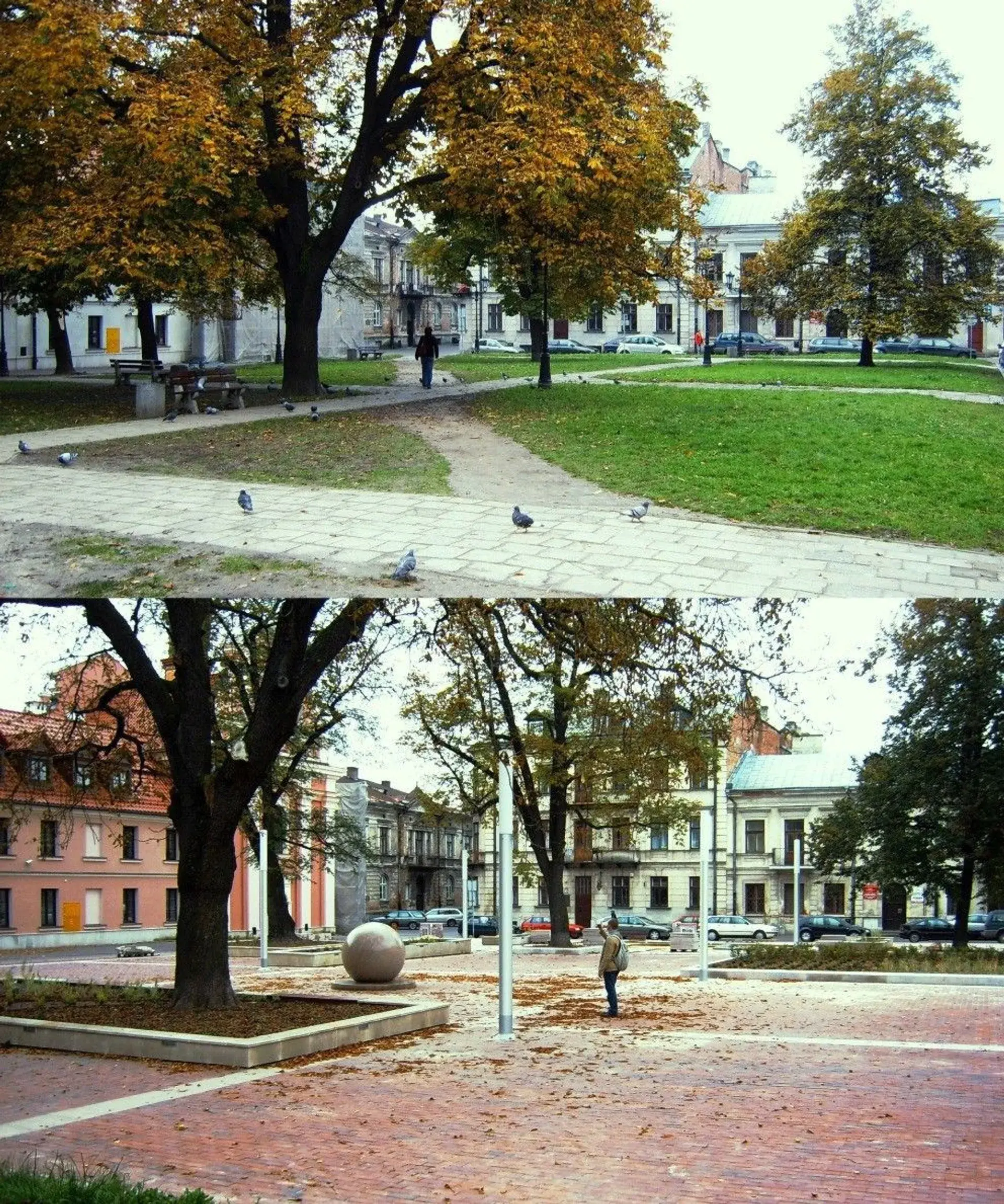
The preservation of Rynek Wodny as an open public space was once fiercely contested. In 1931, the city magistrate rejected a formal police petition to build an administrative canteen directly on the plaza, officially declaring that the open square was indispensable as an "air reservoir" to ventilate the dense urban fabric of the Old Town. After serving as a shaded municipal green space through the mid-20th century, the square underwent a comprehensive revitalization in 2010.
Today, Rynek Wodny is a paved pedestrian square connecting the historic town center to the southern ramparts. The redesign introduced granite paving, seating, drinking water points, and an illuminated, computerized fountain. Set within the geometric stone patterns is a polished granite sphere, installed as a deliberate architectural tribute to the Renaissance concept of mathematical perfection that governed the founding of Zamość.
FAQ
Why is the square called Rynek Wodny if no trade happened there?
Rynek Wodny translates to 'Water Market,' taking its name from its proximity to the southern ramparts and the Wielka Zalewa, a defensive water basin fed by the Łabuńka River. Despite being labeled a market, it was strictly reserved for the residences of Chancellor Jan Zamoyski's high-ranking officials.
What is the large building on the southern side of the square?
The southern frontage is anchored by a late 17th-century Baroque church and convent complex designed by Jan Michał Link for the Poor Clares. It previously functioned as a military hospital, police headquarters, and orphanage, and now houses the Karol Namysłowski State Music School.
What is the meaning behind the granite sphere on the square?
Installed during the 2010 revitalization of the plaza, the polished granite sphere serves as a geometric tribute to the Renaissance 'ideal city' concept used by Bernardo Morando to design Zamość.
Gallery