Calle Estafeta: Pamplona’s Bull Run Straightaway
The Core Straightaway of the Encierro
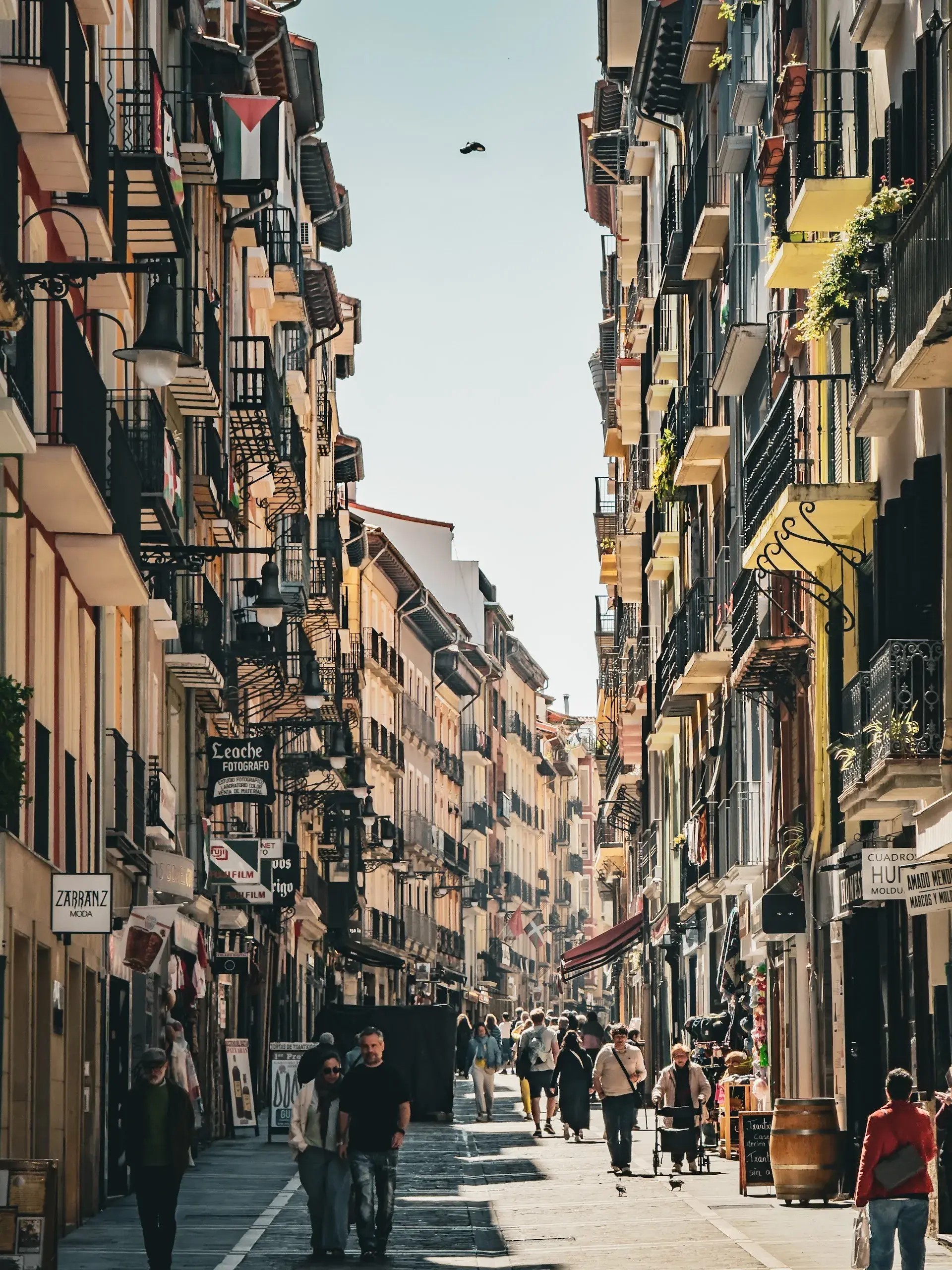
Located in the historic Navarrería borough of Pamplona's Old Quarter, Calle Estafeta is a narrow street measuring between 250 and 300 metres long. It forms the longest and straightest stretch of the 850- to 875-metre Running of the Bulls (encierro) route. The street connects the city's historic center near the Plaza del Castillo directly toward the bullring district.
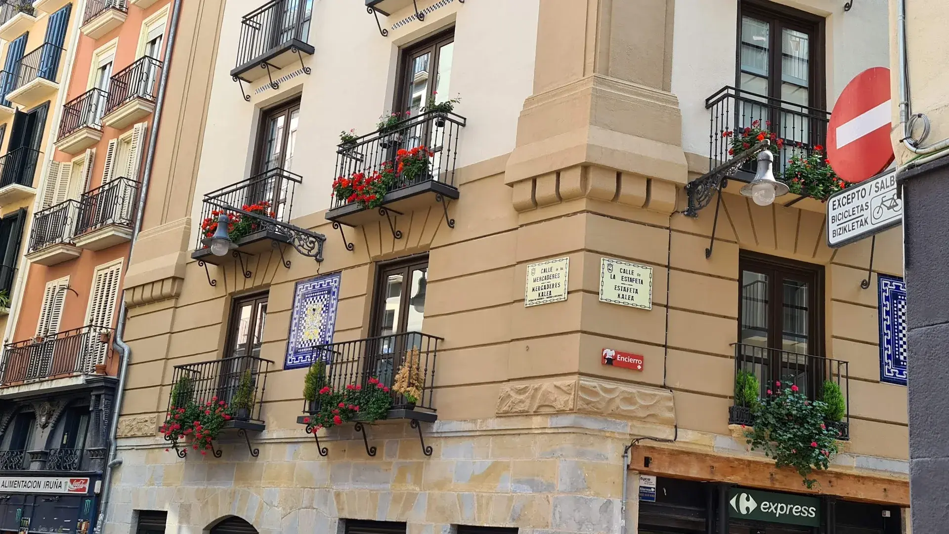
The bulls enter the corridor following a sharp 90-degree turn from Calle Mercaderes. At this corner, the forward momentum of the animals frequently causes them to skid across the stones and collide into the outer wooden barricades before funnelling down the straight. The paving itself consists of granite setts polished smooth by centuries of pedestrian traffic, which become slick when wet and cause both runners and animals to lose their footing. Although Calle Estafeta is the primary section where runners attempt to sprint alongside the herd, the animals typically clear the entire 300-metre straight in only a few seconds.
Historical Origins and the 1856 Rerouting
Predating its modern association with the festival, the street served as a historic city corridor known by several early names over the centuries, including Rúa de Araya y de las Eras, Rúa de la Zaga del Castillo, Rúa Tras del Castillo, and Calle de San Tirso. In the 19th century, it was renamed Calle Estafeta after Pamplona's first postal courier station (estafeta), which operated along the route.
The street became part of festival history in 1856. In that year, Pamplona opened a new Plaza de Toros, requiring the bull run to be redirected away from its traditional finish line in the Plaza del Castillo. Incorporating Calle Estafeta provided a straight route to channel the herd toward the new arena, permanently establishing the geography of the modern event.
Architecture and Noble Heritage
Calle Estafeta is lined with four- to five-storey buildings constructed of warm sandstone and stucco. The facades are characterized by wooden shutters and iron balconies crafted during the 18th and 19th centuries. During the annual San Fermín festival held from July 7 to 14, these private residential balconies are commercially rented out to spectators seeking an elevated vantage point for the morning runs at 8:00 AM.
The street's most notable architectural landmark is the Goyeneche Palace. Constructed in the 18th century in the Baroque style, the palace belonged to a noble family from the Baztán valley and still displays the original stone family coat of arms on its facade.
Daily Life, Gastronomy, and the Camino
Outside festival periods, Calle Estafeta operates as an active pedestrian street. It serves as a thoroughfare for local shoppers and visitors, as well as pilgrims walking an urban stage of the Camino de Santiago.
The street level is filled with local shops, cafés, and pintxo bars. In the evenings, it functions as one of Pamplona's primary culinary circuits, where patrons gather to sample traditional regional fare such as chistorra sausage and tortilla. Permanent plaques and street signs remain mounted to the facades throughout the year, allowing visitors to trace the path of the bull run in any season.
FAQ
Why is the street named Calle Estafeta?
The street was renamed in the 19th century after Pamplona's first postal courier station, or estafeta, which was located along this thoroughfare.
When was Calle Estafeta added to the Running of the Bulls route?
It was integrated into the encierro in 1856 to redirect the bulls to the newly inaugurated Plaza de Toros, shifting the finish away from the Plaza del Castillo.
What makes Calle Estafeta particularly hazardous during the encierro?
A sharp 90-degree corner at the entrance causes bulls to skid into wooden barricades, while the street's centuries-old granite paving stones become dangerously slippery when wet.
Discover Pamplona like never before
Dive into Pamplona hidden stories and secret spots with Ciceru interactive tours.
Explore tour
Audioguide
Quizzes
Maps
Solo
Couples
Groups & families

© Photo by Llargo Bike via Google Maps · Google Places